The earthquake that struck the East Coast earlier this month was felt by an estimated 42 million people and luckily caused little damage, but what are the chances of a bigger, more powerful quake striking the area? And if it does, what could it look like — and are we prepared?
The April 5 phenomenon was a 4.8 magnitude earthquake centered near Whitehouse Station in New Jersey, which is about 40 miles west of New York City.
Shaking was felt from Washington D.C. to Maine, according to the U.S. Geological Survey (USGS), and it followed a much smaller, 1.7 magnitude earthquake in New York City on Jan. 2.
Earthquakes are rare along the East Coast, with the most powerful one in the last 100 years hitting in August 2011, clocking 5.8 on the Richter scale. It was centered in Virginia and felt from Washington, D.C. to Boston.
4.8 MAGNITUDE EARTHQUAKE STRIKES NEW JERSEY, SHAKING BUILDINGS IN SURROUNDING STATES
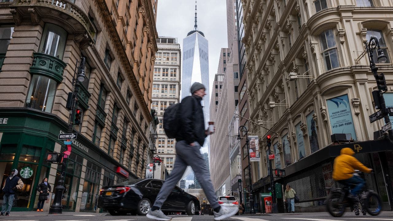
A man walks through Lower Manhattan moments after New York City and parts of New Jersey experienced a 4.8 magnitude earthquake on April 5, 2024.
Before that, an earthquake in South Carolina in 1886 is understood to have measured between 6.6 and 7.3 on the Richter scale. There is no definitive measurement of that quake since the Richter scale has only been around since the mid-1930s, but the tectonic shift still killed 60 people.
Professor John Ebel, a seismologist in the Department of Earth and Environmental Sciences at Boston College, tells Fox News Digital that when quakes start breaking 5.0 on the Richter scale, damage begins to occur.
For instance, the devastating earthquake that hit Turkey and Syria last year measured 7.8 and resulted in the death of nearly 62,000 people as tens of thousands of buildings were either destroyed or severely damaged.
California’s Loma Prieta earthquake in 1989, meanwhile, measured 6.9 and caused 69 deaths, and the 1994 Northridge earthquake in the Golden State clocked 6.7, killing 57 people. Thousands more were injured.
“As you go above magnitude five, the shaking becomes stronger and the area over which the strong shaking is experienced becomes wider,” Ebel says. “So if you get a magnitude six, the shaking is ten times stronger than a magnitude five. So had this month’s earthquake been a 5.8, rather than a 4.8, then we would be looking at damage to unreinforced structures in the greater New York City area.”
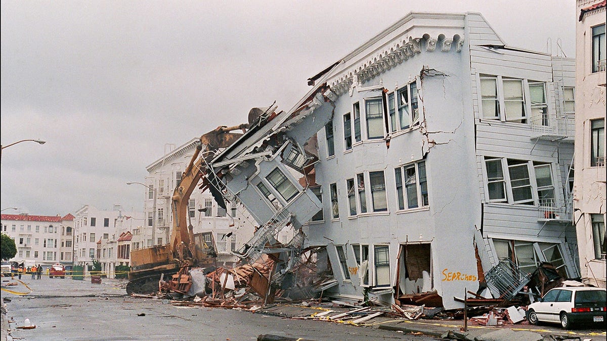
The front of an apartment building in the Marina District in San Francisco is ripped off after a quake erupted in October 1989. (Photo by JONATHAN NOUROK/AFP via Getty Images)
“Now I have to qualify this and say that in the past few decades, New York City has had an earthquake provision in its building code while New Jersey, New York and Connecticut have all adopted some version of earthquake provisions in their building codes,” Ebel explained. “So modern buildings that are put up today will actually do quite well, even in strong earthquake shaking… If you have a magnitude 6 or even a magnitude seven.”
In terms of the Tri-state area, Ebel says that the region has had smaller earthquakes, but it’s been spared anything that’s been significantly damaging.
An 1884 quake in Brooklyn did cause limited damage and injuries. Seismologists estimated it would have measured in the region of 5.0 and 5.2, while a quake jolted Massachusetts in 1775 in the region of 6.0 and 6.3.
WHAT TO DO DURING AN EARTHQUAKE AND HOW TO PREPARE
“In 1884 there were things knocked from shelves, some cracks in walls that were reported, particularly plaster walls, which crack very easily if a building is shaken,” Ebel said. “There were some brick walls that had some cracks and people panicked because of the very strong shaking.”
A magnitude five earthquake hits the tri-state area once every 120 years, says Ebel, who penned the book “New England Earthquakes: The Surprising History of Seismic Activity in the Northeast.”
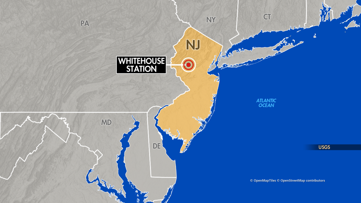
A map shows the location of Whitehouse Station, New Jersey, which the U.S. Geological Survey reports was the epicenter of a 4.8 magnitude earthquake on April 5. (Fox News)
“The question is, can we have something bigger? And in my opinion, yes we can,” he said. “We can’t predict earthquakes, and we don’t know when the next one is going to occur, but we do have a low, not insignificant probability of a damaging earthquake at some point.”
Ebel said that the April 5 earthquake has left seismologists baffled since it didn’t occur on the Ramapo Fault zone, highlighting just how hard it is to predict the phenomenon from occurring. The Ramapo Fault zone is a series of small fault lines that runs through New York, New Jersey and Pennsylvania. Spanning more than 185 miles, it was formed about 200 million years ago.
“Right now it’s a seismological mystery,” Ebel said. “We have some earthquakes in our region where we don’t have faults mapped. But that’s even true in California. Not every earthquake occurs on a known or mapped fault in California, so there are still a lot of seismologists have to learn about the exact relationship between old faults and modern earthquakes.”
Ebel noted that buildings aren’t the only thing to consider when earthquakes strike. In the California quakes, overpasses crumbled while the electrical grid can go down too, causing electrical surges and fires.
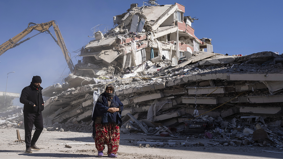
Local residents walk in front of a destroyed building in Nurdagi, southeastern Turkey, on Thursday, Feb. 9. (AP/Petros Giannakouris)
Toxic chemicals were knocked off of the shelves of a chemistry building in 1989 and the building had to be evacuated, Ebel said.
“And you think about hospitals and some industrial facilities having that situation,” he explained. “So you have these things that are not catastrophic necessarily, but are going to be a real problem.”
And an earthquake doesn’t necessarily have to rattle land in order to cause destruction.
A jolt out at sea could trigger a dangerous tsunami, like the one on the edge of the Grand Banks of Newfoundland in Canada in 1929. It was felt as far away as New York City.
Waves as high as 23 feet crashed on the shore, according to the International Tsunami Information Center, with up to 28 people losing their lives.
“A tsunami is not necessarily a very high probability event, but it’s one that we have to think about also,” Ebel says in relation to the East Coast.
The Fukushima nuclear accident in 2011 was triggered by an earthquake and subsequent tsunami.
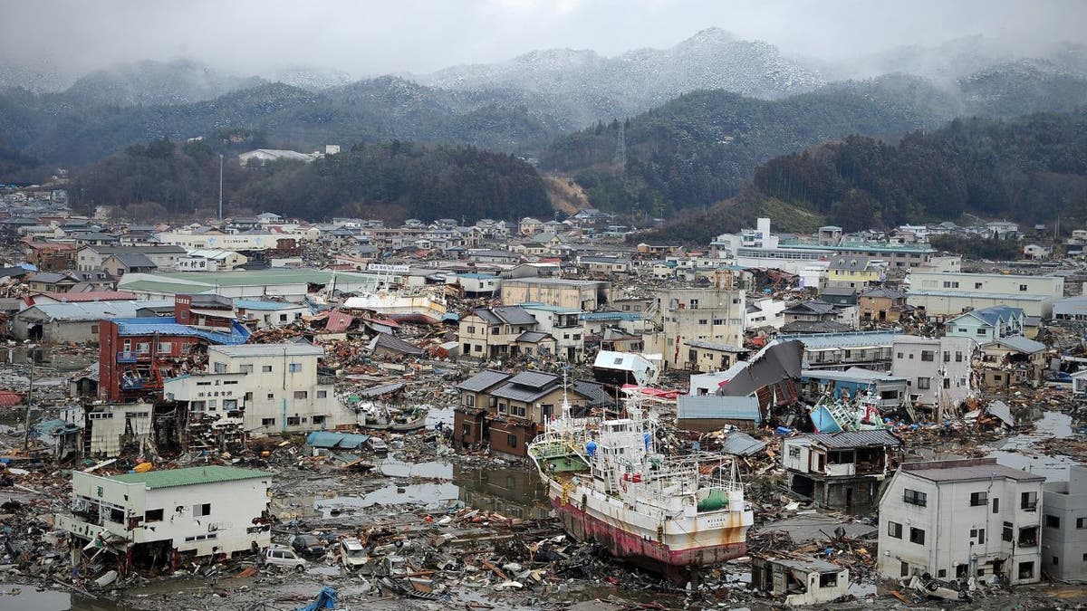
Damage caused by the 2011 tsunami is seen from a hill overlooking the city of Kesennuma. ( Phillipe Lopez/AFP via Getty Images)
CLICK HERE TO GET THE FOX NEWS APP
Ebel says a tsunami similar to 1929 could cause a storm surge along the lines of Hurricane Sandy in 2012, where 43 people died in New York City.
“The threat of an earthquake is not as great as in California, but it’s something that we have to take into account and have emergency plans for and have building codes for,” Ebel says. “Our state and local emergency management agencies in all the northeastern states do earthquake planning — what we call tabletop exercises — where they pretend an earthquake occurs.”
“So those kinds of preparations are made on a regular basis,” he concludes. “Building codes are constantly being reevaluated and approved, not just for earthquakes, but for fires and chemical spills and all kinds of things. So we’re getting more prepared all the time.”

Marina Beach in southern India after tidal waves hit the coast in 2004.

